Thursday, May 31, 2007
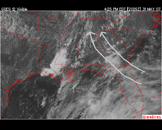
Smoky Locally.....Tropics Abuzz
Wednesday, May 30, 2007
Pattern Change Coming?
With a weakening of this high pressure ridge, an upper level trough will replace it. An upper level trough can help destablize the air enough to help trigger some afternoon showers locally. So, this pattern is not a drought buster. But, at the very least, could help stop the persistently dry pattern we have experienced for much of May. It will also become muggier with the increase in humidity, so morning temps may not be as comfortable as they have been lately. The long range projections do indicate that we may stay with this pattern the first 10 days of June. I will keep you posted.
Computer Model Links: GFS (American Model): Link
ECMWF (European Model): Link
Local Web Drought Headlines: Hiwassee Recreation Effected by Drought (Link)
Great Arictle on the "Hows" and "Whys" of Drought (Link)
Drought Update from The Peach State (Link)
Please be sure to stay up to date with local conditions on Newschannel 9. You can view today's webcast and live radar at www.newschannel9.com.
Monday, May 28, 2007
Drought at Extreme Level....Any Relief?
Please be sure to view my latest Webcast which will describe the upcoming 7 Day weather pattern changes (Webcast Link) .
Tuesday, May 22, 2007
Busy Hurricane Season Expected
Monday, May 21, 2007
Summer Outlook...Hot
The Climate Prediction Center has released its outlook for the next 90 days and it looks hot. Please refer to my May 10th posting about why I believe that the drought we are experiencing could lead to a hotter than normal summer. The rainfall expectations are mixed with our region being in the "EC" category. This means that we have equal chances of being above or below normal. Again, I believe the upcoming tropical season will determine how wet we will be this summer and early fall.
Weather Web Headlines:
Wildfires affecting Smoky Mountains near Cades Cove (link)
Clear nights are perfect for star gazing, here is a great link that shows what's seen in our local skies (link)
Friday, May 18, 2007
Beautiful Weekend Ahead
Thursday, May 17, 2007
Mid-May Chill
A chill in mid May is often called "Blackberry Winter". Granted, this cool spell is nowhere near the record cold of April, but it is below normal. Our normal low temperature this time of year is 56 degrees, we should be about 10 degrees below that value Friday through Sunday morning. Thursday morning was just the start of the cooling trend, here is a sampling of this morning's lows:
Ft Payne, AL: 41
Robbinsville, NC: 41
Crossville, TN: 43
Murphy, NC: 46
Dalton, GA: 50
Chattanooga: 52
Most areas in the lower elevations should see temperatures in the upper 40s by Friday morning. The mountain tops should have readings in the lower 40s and even a few upper 30 degree readings in the highest elevations of the Blue Ridge Mtns (Big Frog Mtn, Grassy Mtn). Morning temperatures over the weekend should be in the middle 40s valley locations and near 40 mountains. The weekend looks outstanding with sunshine and warm afternoons from 75 to 80 degrees.
Today's Weather Web Headlines:
Smoke from South Georgia Wildfires Reaches Atlanta (link)
Improved Hurricane Monitoring this Season (link)
National Hurricane Center vs NOAA for Funding (link)
Please be sure to read my other postings from the past week regarding other weather headlines from around the Tennessee Valley.
Wednesday, May 16, 2007
Stirring Up The Dust
Tuesday, May 15, 2007
Showers Coming, But Not A Drought Buster
Monday, May 14, 2007
Changes Ahead for the Week
Friday, May 11, 2007
Mother's Day Weekend
You can stay up to date on the latest weather conditions at www.newschannel9.com.
* StormTrack 9 Live Super Doppler
* StormTrack 9 7-Day Forecast & Video Web Cast
* StormTrack9 Live Neighborhood Net
Happy Mother's Day!!!!!! Have a safe weekend!
Watching the Doppler this Afternoon/Evening
Thursday, May 10, 2007
Severe Drought....Hot Summer Ahead?
As of today, our yearly rainfall deficit stands at just over 10 1/2 inches. This is coming off a very dry year locally in 2006. These conditions have led to our region being placed under the "Severe Drought" category by the US Drought Monitor (1st picture on left). The Drought Monitor closely studies the entire country and determines the severity of dry spells. These drought conditions leading into the summer, could cause a warmer than normal summer.
A normal rain pattern would have led to an ample ground supply of water. Moisture in the top layer of the soil can serve to keep temperatures in check through evaporation. Granted, the added moisture in the air provides a muggy feeling, the evaporation and evapotranspiration process will keep air temperatures near seasonal levels. A parched, dry soil layer will absorb and retain the heat, therefore warming the air and leading to above normal temperatures. Again, on the flip side, it is not as humid, but very hot. The 2 week temperature trend keeps us in the above normal category. So, unless a wetter than normal pattern begins to take hold in June, we could be in for a hot summer. Please see my earlier post (Tuesday) about an active Gulf tropical season and our chances of rain.
Locally, our chance of at least some scattered showers will be a little higher through Saturday. Please be sure to see our Live Super Doppler for frequent updates. Mother's Day should be dry and warm, followed by another dry start to the upcoming week. Please see the Storm Track 9 7-Day Forecast and Video Webcast.
Andrea Downgraded
After only 24 hours as the seasons first named storm, Andrea has been downgraded to a tropical depression. The remnant depression will continue to lurk and weaken off the Florida coast. The heaviest rain will stay well east of the depression's center, out to sea. Only scattered showers will reach the Florida/Georgia coast. So, not much help provided for all of the fires down there. In fact, the depression is doing more harm than good, because the wind is fanning the flames.
Wednesday, May 9, 2007
Hello Andrea!
Tuesday, May 8, 2007
Sunglasses on the Moon?
We experienced some outstanding weather again Tuesday, but we are in dire need of some rain. Our yearly deficit stands at just under 10 and 1/4 inches. Only scattered showers are possible to end the week, and not the all around soaking rains that we need. It is so dry that parts of the Peach State have burn bans. See this link for more details: Walker County Burn Ban.
As we get closer to the summer season, our chances for rain will be limited to the afternoon variety that routinely pops up. Because of the scattered nature of these showers, not every location will benifit from the rainfall. Outside of the afternoon variety of showers, what we will have to watch is the activity in the tropics. Nobody wants to root for an active season, but active Gulf years tend to help our region with rainfall. The National Hurricane Center will release thier seasonal forecast Monday, May 14th. However, early outlooks have already been released by the Colorado State University team of Dr. Gray and Phillip Klotzbach. Accu-Weather's hurricane expert Joe Bastardi has also chimed in with his outlook. The National Hurricane Center projection usually closely mirrors the Colorado State numbers. Early outlooks are pointing toward more activity in the tropics, especially in the Gulf. Again, while this may cause some jitters in coastal communities, folks inland (like us), will have a different view of increased Gulf activity in hopes of more rain. You can read a brief synopsis of the early forecasts at this link: Early Season Hurricane Forecasts. I will provide a link to the NHC forecast on Monday.
Some pre-season excitement with a current non-tropical low pressure system off the southeast US Atlantic coast. Hurricane Hunter aircraft might investigate this system should it persist in the Atlantic waters and gain more tropical characteristics. Regardless, it is generating gale force wind gusts and beach erosion off the Carolina, Georgia and Florida coasts. Check out the status and satellite images of this system at this link: Southeast Coast Low
Be sure to check out my daily video webcast at NewsChannel9.com